| dc.contributor.author | Fischer, Lisa E. | en_US |
| dc.contributor.editor | Franco Niccolucci and Matteo Dellepiane and Sebastian Pena Serna and Holly Rushmeier and Luc Van Gool | en_US |
| dc.date.accessioned | 2013-10-31T10:33:40Z | |
| dc.date.available | 2013-10-31T10:33:40Z | |
| dc.date.issued | 2011 | en_US |
| dc.identifier.isbn | 978-3-905673-86-9 | en_US |
| dc.identifier.uri | http://dx.doi.org/10.2312/PE/VAST/VAST11S/077-080 | en_US |
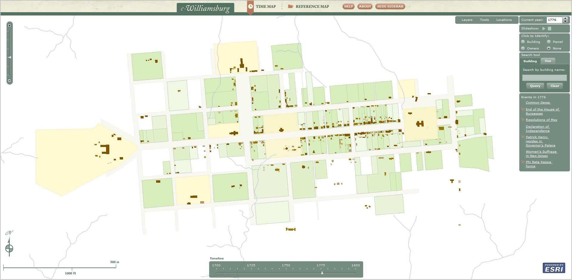
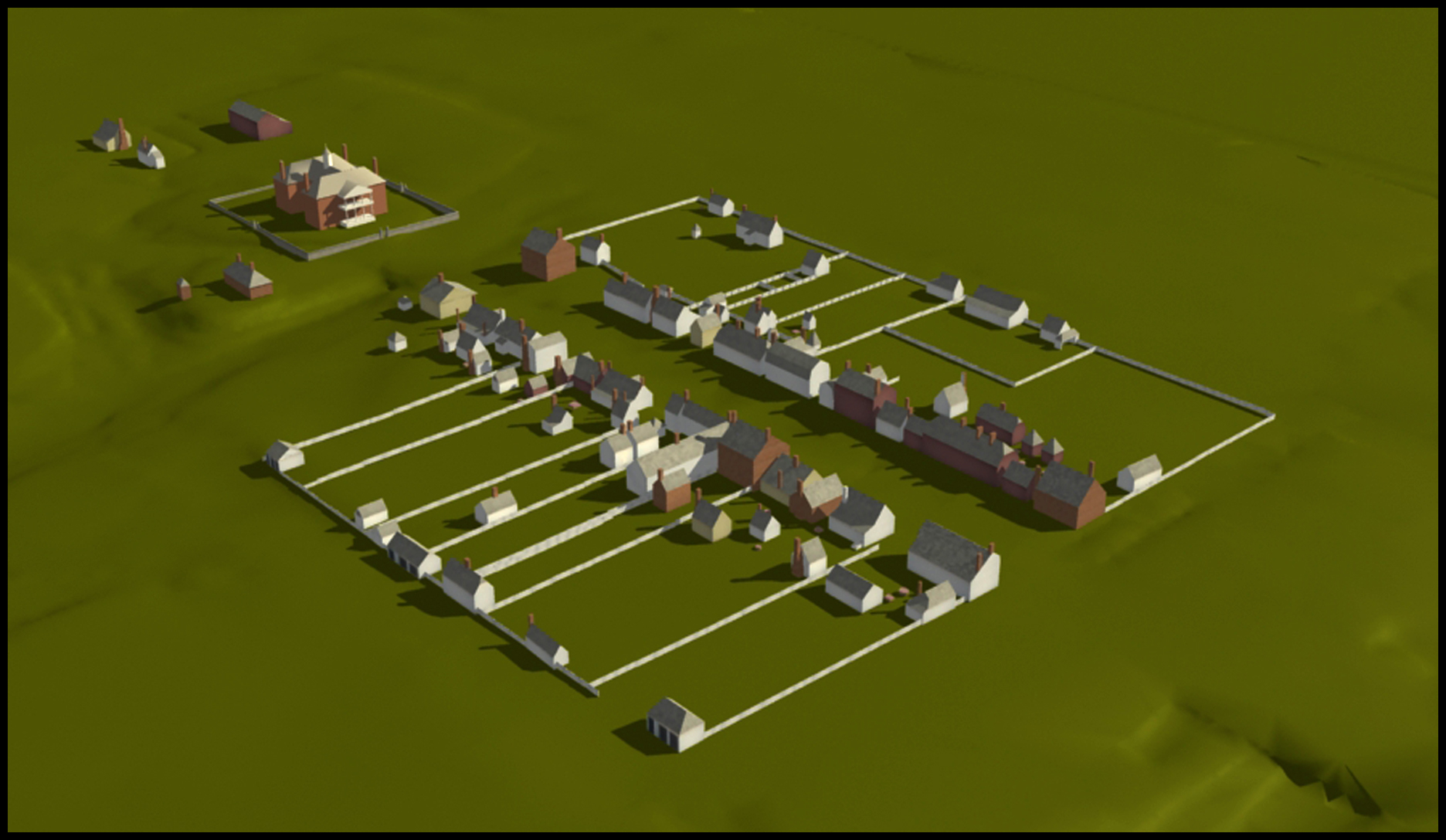
| dc.description.abstract | Williamsburg, the capital of Virginia from 1699 to 1780, has been the subject of extensive research for more than eighty years. However this research has never been assimilated to look at the development of this planned city, not at a site level but at a town level. Two digital projects, eWilliamsburg and Virtual Williamsburg, are now seeking to visualize this data in new ways. In 2010, Colonial Williamsburg launched the temporal eWilliamsburg map, an interactive tool for depicting the town's layout for any year in the eighteenth century and for querying information about the structures and residents. Building upon eWilliamsburg, the ongoing Virtual Williamsburg project is using 3D modeling to virtually reconstruct the town as it looked in 1776. Not only are these projects providing novel insights into Williamsburg's eighteenth-century history but, perhaps even more importantly, they are resulting in new online tools for educating and engaging the public. | en_US |
| dc.publisher | The Eurographics Association | en_US |
| dc.subject | Categories and Subject Descriptors (according to ACM CCS): I.3.6 Methodology and Techniques | en_US |
| dc.title | Visualizing Williamsburg: Modeling an Early American City in 2D and 3D | en_US |
| dc.description.seriesinformation | VAST: International Symposium on Virtual Reality, Archaeology and Intelligent Cultural Heritage - Short and Project Papers | en_US |